
")
Scientists have known for a while that the melting of glaciers has led to earthquakes in tectonically stable regions like the interior of Canada and Scandinavia. Since earthquakes are common in the southern part of the region, it has been much harder to observe this pattern in Alaska.
In a recently published research, scientists from the University of Alaska Fairbanks Geophysical Institute have found a relation between the melting of glaciers near Glacier Bay National Park and the timing and location of earthquakes in the area in the past century with a magnitude of 5.0 or greater.
Some of the largest glaciers in the world can be found in Alaska. These are thousands of feet in thickness and are spread over a region of hundreds of square miles. The weight of the ice cause the land beneath to sink. When a glacier melts, the ground springs back like a sponge.

Chris Rollins, the study’s lead author who conducted the research while at the Geophysical Institute said, “There are two components to the uplift. There’s what’s called the ‘elastic effect,’ which is when the earth instantly springs back up after an ice mass is removed. Then there’s the prolonged effect from the mantle flowing back upwards under the vacated space.”
Researchers have found a link between the described movement of the mantle and earthquake in southeast Alaska, where the melting of glaciers has been observed for around two centuries. Greater than 1,200 cubic miles of ice have been lost. Southern Alaska is situated between the continental North American Plate and the Pacific Plate. They rub past each other at around two inches per year, which leads to frequent earthquakes.
Melting of glaciers and land rise
The melting of glaciers has also led to the rising of Southeast Alaska’s land at around 1.5 inches per year. The researchers ran models of ice loss and earth movement since the 1770s. They found a subtle but unmistakable correlation between earthquakes and earth rebound.
Combining the maps of melting of glaciers and shear stress with seismic records till 1920, the researchers found that most of the large earthquakes correlated with the stress from long-term earth rebound.
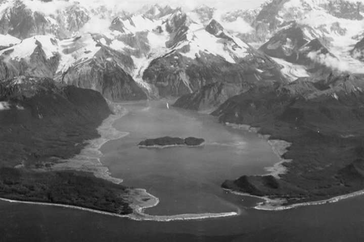
The greatest amount of stress from loss of ice was found to have occurred near the epicentre of the 1958 earthquake that caused the Lituya Bay tsunami. In 1958, an earthquake of magnitude 7.8 triggered a rockslide into Southeast Alaska’s Lituya Bay. This created a tsunami running 1,700 feet up a mountainside before reaching for the sea.
Even though the melting of glaciers is not a direct cause of earthquakes, it is likely to affect their timing and severity. The rebounding of the earth after the loss of ice is similar to bread rising in the oven, spreading in all directions. These unclamp strike-slip faults making it easier for the two sides to slip past each other.
In 1958, the postglacial rebound of the earth torqued the crust around the fault that increased stress near the epicentre. This, combined with the unclamping effect led to the failure of the fault, and hence the earthquake.
Rollins said, “The movement of plates is the main driver of seismicity, uplift, and deformation in the area. But postglacial rebound adds to it, sort of like the de-icing on the cake. It makes it more likely for faults that are in the red zone to hit their stress limit and slip in an earthquake.”
Further Reading: